Distance-Based Road Pricing: GNSS Tolling and the Evolution of Electronic Toll Collection in India
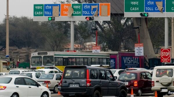
What happened
The Ministry of Road Transport and Highways (MoRTH) plans to introduce satellite-based (GNSS/GPS) toll collection on select national highways by 2028-29, so that motorists pay only for the distance they travel. Officials said it will complement FASTag and multi-lane free flow (MLFF) tolling. MoRTH has commissioned a fully funded centre of excellence to research a foolproof system, subject to technical readiness and expanded satellite navigation coverage.
Key takeaways
- GNSS tolling uses satellite positioning and on-board units to charge by distance on tolled stretches, replacing fixed-point flat fees. This operationalises the user-pays principle more equitably, and exam questions often ask about efficiency and equity in infrastructure financing.
- India's toll evolution runs from manual booths to FASTag (RFID, mandatory since 2021) to barrierless MLFF to GNSS. Tracing this sequence is a common Mains theme on technology-driven governance reform.
- NavIC, India's regional navigation system under ISRO, gives a sovereign alternative to US GPS. This links strategic autonomy and space technology to infrastructure, and is a likely Prelims fact.
- Key challenges are enforcement against violators, interoperability, cybersecurity, data privacy and grievance redressal, alongside revenue leakage risks for concessionaires. These tie to the Digital Personal Data Protection Act, 2023 and the surveillance-versus-efficiency debate.
- Contemporary example: MoRTH targets select stretches by 2028-29, and cameras and enforcement may still be needed, so a phased rollout is likely.
Conceptual analysis
Road tolling in India has moved from manual cash collection at plazas to electronic collection through FASTag, an RFID-based system run by NPCI and NHAI, which became mandatory for all four-wheelers in 2021. Plazas still cause bottlenecks and charge flat fees irrespective of distance travelled. MLFF removes barriers but still needs gantries and cameras. GNSS-based tolling is the next step. A vehicle's on-board unit communicates its position through satellites, the system maps it against geo-fenced tolled highway segments, and it automatically debits a distance-linked fee. Benefits include shorter travel time, lower fuel use and emissions from idling, fairer pricing for short-distance users, and lower civil infrastructure and operating costs. Germany, Slovakia and others already use variants, mostly for trucks. India has an advantage in its FASTag ecosystem, vehicle registration databases (Vahan) and NavIC, which can improve positioning accuracy over the subcontinent. Risks remain. These include enforcement against non-compliant or tampered devices, interoperability across vehicle types, cybersecurity, location-data privacy under the DPDP Act, 2023, grievance redressal, and revenue leakage for concessionaires under BOT/TOT/InvIT models. Rural connectivity and satellite coverage in tunnels or hills also matter. A phased rollout, beginning with commercial vehicles or select corridors, is therefore most likely. Done well, it can improve logistics efficiency and cut logistics costs, supporting the National Logistics Policy.
Concept explainers
Global Navigation Satellite System: a constellation of satellites providing positioning and timing, such as GPS, GLONASS, Galileo and NavIC.
Navigation with Indian Constellation: ISRO's regional system covering India and about 1,500 km around it.
RFID-based electronic toll payment tag fixed on windshields, linked to prepaid or bank accounts.
Barrierless tolling where vehicles are identified by gantry-mounted sensors and cameras at normal speed.
Those who use a public facility bear the cost in proportion to use.
In-vehicle device that transmits location data for toll computation.
Syllabus tags
Source: Livemint, 18 Oct 2026
Read today's current affairs
Sign up free for daily UPSC concept cards, Prelims practice, and Mains evaluation.